Why we measure this
In support of the Prairie Resilience climate change strategy, Saskatchewan has committed to protecting 12 per cent of the province's terrestrial areas and inland waters – areas that represent our diverse natural ecosystems.
What is happening

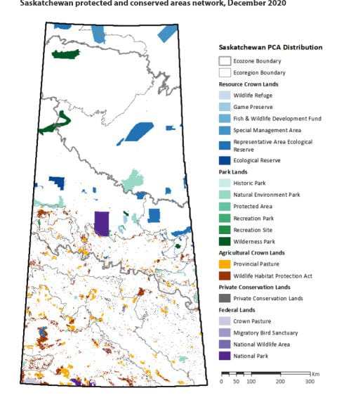
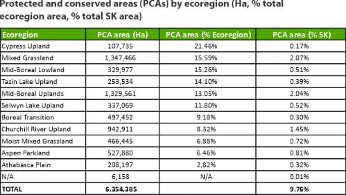
Protected areas are added to the provincial Protected and Conserved Areas Network each year. To date, 6,390,710 ha or 9.81 per cent of Saskatchewan's land and waters are contained within the network.
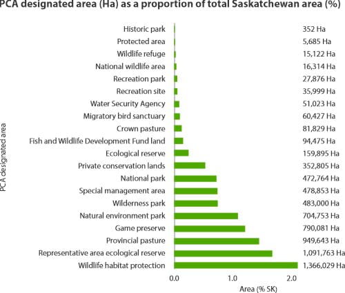
A range of approaches is used for conservation – from traditional tools such as parks and ecological reserves to working landscapes conserved through the Wildlife Habitat Protection Act and conservation agreements with ranchers.
A multi-ministry working group assesses and prioritizes areas for conservation by:
- identifying appropriate tools for protection based on ecological value, land tenure, economic potential and cultural significance;
- establishing a work plan to achieve provincial goals for biodiversity conservation; and
- identifying actions and challenges associated with meeting provincial and national targets.


Note: N/A indicates PCAs outside of the ecoregions listed, as Saskatchewan’s Ecoregion Boundary dataset excludes a small portion of Saskatchewan’s total area.

Note: Individual Designated Area statistics do not account for overlap within the PCAN; therefore, hectare values should not be summed within this figure.


